Categories
The hikes

The Robion

Mont Robion

The summit of Robion

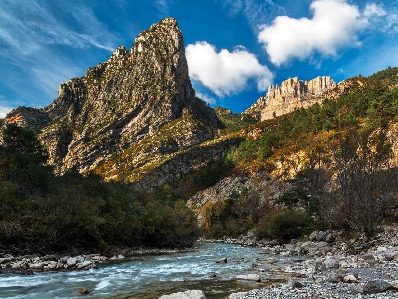
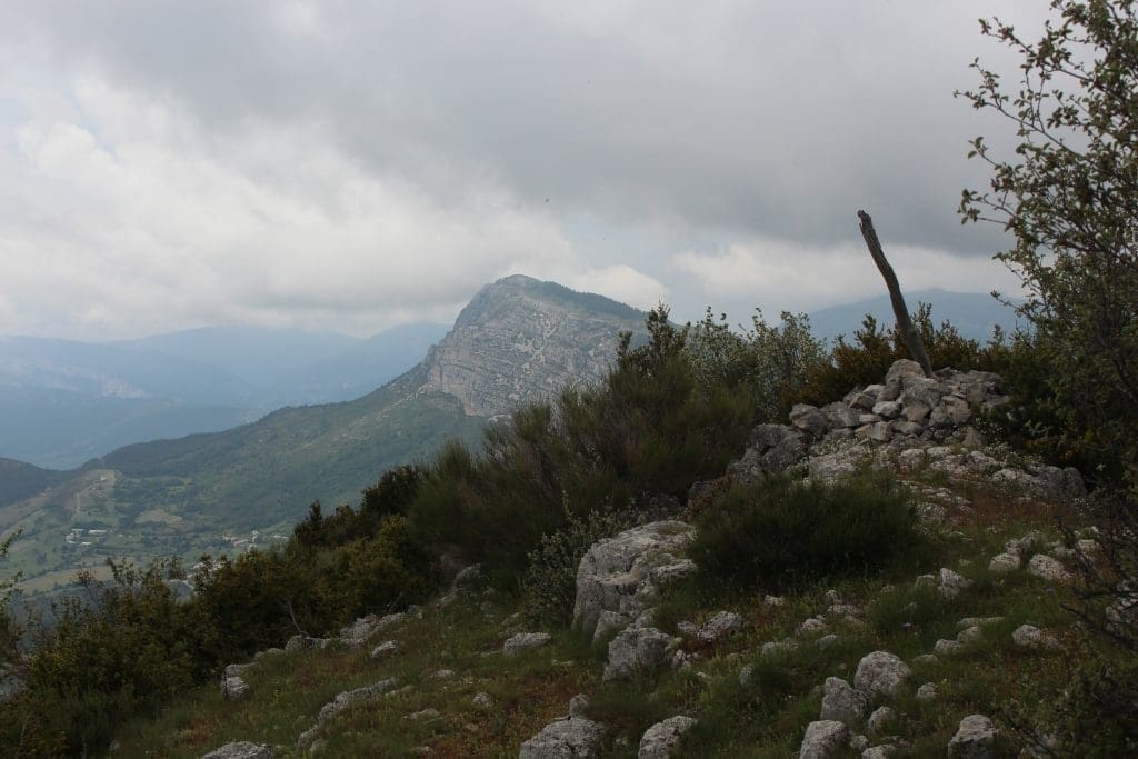
The Robion is one of the highest peaks around Castellane , it culminates at 1660 m .

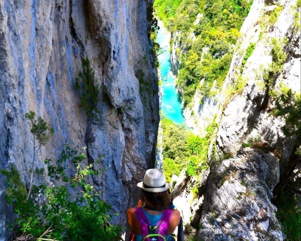
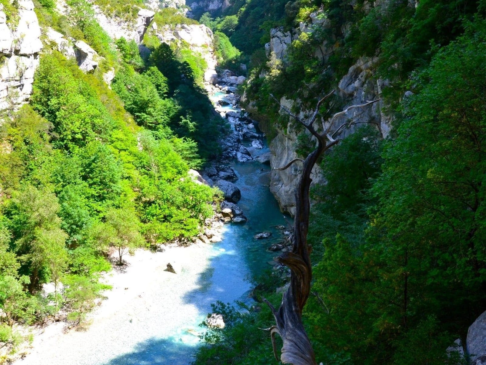
This mountain dominates the Gorges du Verdon and offers a 360° panorama. You will find severalTreks to climb to its summit or go around it. This mountain presents two different sides. The north side is wooded and rounded. And the south side is very vertical, and you can find the Chapel of St Trophine hidden under a rock.

You have the choice between two main routes, one will take you directly to the summit. And the other will take you around the mountain, taking you through the village of Robion and Petit Robion . And from there you can also access the Sainte Torphine chapel.

In order to climb the summit you will have to pass in front of the old swimming pool of Castellane in the direction of Le Bourguet. Then, pass a small winding road, which will take you to the level of a small car park where you can park. Here you will find yellow hiking signs that show you very well the path to take to get to the top. It will take you about 4 hours to climb to the magnificent viewpoint.

Once at the top of the summit of Robion, in the direction of the North, North-West you will be able to admire a mountain landscape. First, you have in the North-West the curve that the Verdon river takes and the Verdon gorges which form this landscape. While heading north, if you are lucky enough to have very clear weather, you can admire the beginning of the Southern Alps, with these peaks sometimes still snow- capped .

On the other side, towards the South, South-East you will admire a completely different landscape. You can find less mountainous, but you will be able to notice a lot more plains. Indeed this landscape extends towards the Mediterranean and benefits from a completely different climate: the vegetation is much drier in this area.

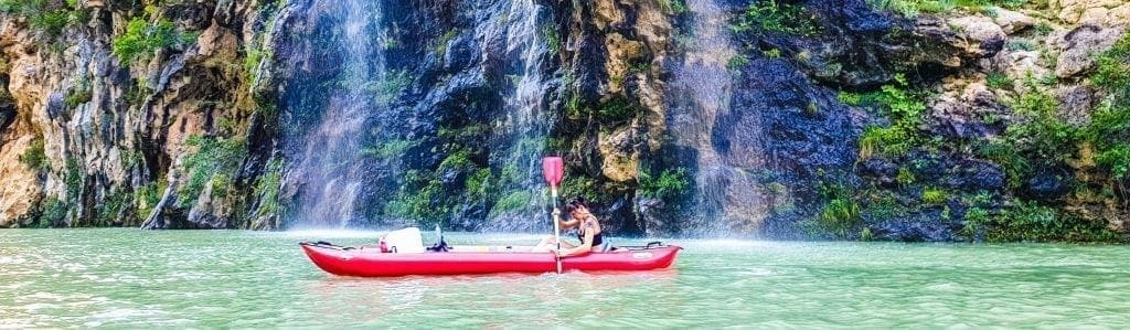
You will also be able to notice that the Rafting and Canoe-Kayak course, starting from Castellane. It runs along the mountain of Robion on its right and almost goes around. The Verdon river therefore has the particularity of having this mountain on its left bank for several kilometres .

Notre Dame du Roc - Castellane Alpes de haute Provence

This mountain sits at the crossroads of Alpine and Provencal tectonics. It shows evidence of the force of nature with beautiful folds and tangles. The relief around Castellane was formed with the creation of the Alps during the Tertiary era, forming part of the Jurassic limestone zone of the Préalpes de Provence .

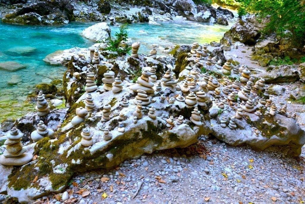
The limestone rocks continue along the Verdon and thus give rise to the spectacular gorges and the canyon . The protection zone of the Haute-Provence geological nature reserve also covers the town of Castellane and therefore Mount Robion.

mount robion
Mount Robion seen from the top of Mount Destourbe

The hamlet of the little Robion

The hamlet of Robion has been part of the municipality of Castellane since 1973. In 1906 this village had no less than a hundred inhabitants . To date, it is estimated that there are only about ten people who lives all year round. Currently this small hamlet has developed into lodges in order to welcome tourists during the summer season. Two small hamlets divide the hamlet of Robion. To the east we will find the “little Robion”. And to the west we have “the great Robion”, between these two hamlets is the church “Notre Dame of the Immaculate Conception ”. You should know that this small hamlet alone has a church and two chapels.

Robion: The small village with two Chapels

  • The Saint-Thyrse chapel : classified historical monument.

This chapel dating from the 10th century, is unfortunately no longer accessible to the general public because it is in the process of being renovated. It was the old parish church of the town of Robion, before it was merged with Castellane. This chapel was classified as a historical monument in 1944, after having been summarily consolidated two years earlier, in 1942 by Father Garnier. Then in the 2000s, infiltration problems were noticed and were the subject of emergency work, which is why today visits are no longer authorized.

  • The Saint-Trophime chapel : The troglodyte chapel.

This chapel perched at the top of the mountain is located at the level of the bars of the mountain of Robion. It is only accessible on foot by taking a steep path at the level of the small hamlet of Robion. Renovating her in 1999, thanks to the support of anonymous individuals, friends, and relatives, aimed to preserve this heritage. So, you can admire paintings as well as a small bench inside.

Castellane, the village of many mountains

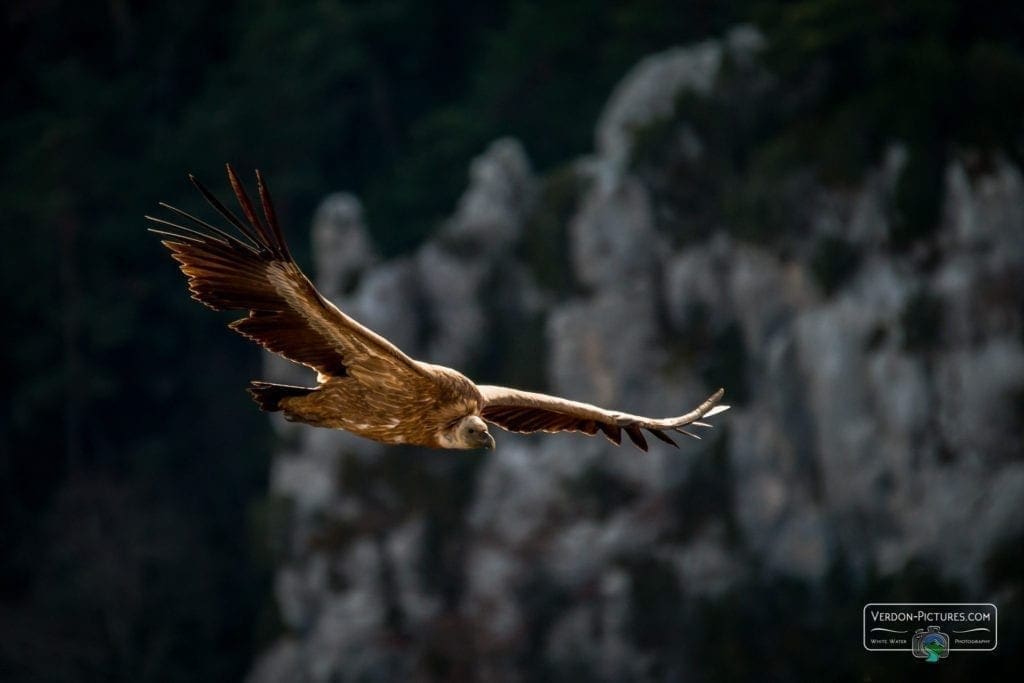
Around Castellane you will find another hike for Mount Destourbe at 1545 m a little more accessible than Mount Robion. The climb is gradual and offers beautiful views of the Chaudanne reservoir. Then, spectacular views will impress you when you reach the top, with the vultures that hover over you.

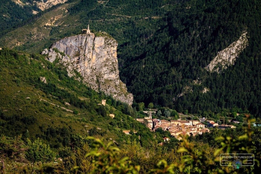
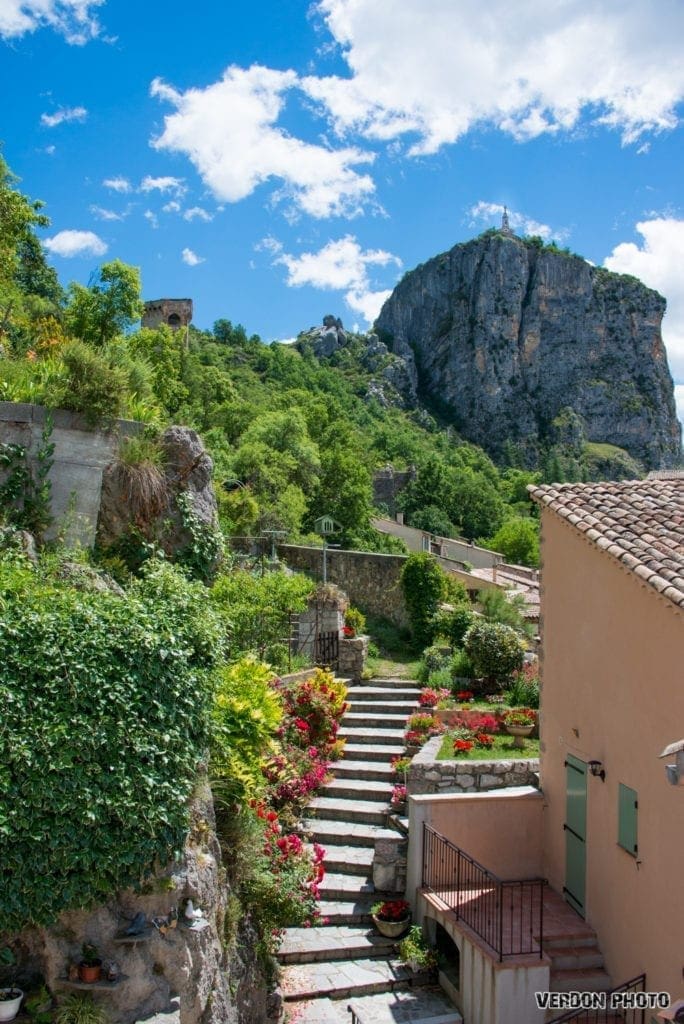
If you want to walk only two short hours there is the climb to the Roc of Castellane with its church which dominates the village at 895m. It is an accessible climb for families with a visit to the ruined city of Pietra castellana .

Castellane Gorges du Verdon - le Roc

Haute Provence Outdoor also invites you to explore the region with a guided tour around the village of Trigance on an electric scooter. Accompanied by a passionate nature guide, he will tell you the story of the Gorges du Verdon

Some activities around Castellane

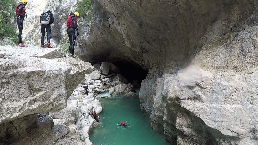
Haute Provence Outdoor offers you various activities to discover the region ! For example, around Castellane we propose rafting, kayaking, aqua hiking and even Trott’Elec. With family, friends, whether you are looking for beginner or more sporty courses, there is something for everyone!

Canoe rental - lake of sainte Croix du verdon
Categories
The hikes

The Blanc Martel trail

The Blanc Martel trail, the hike to discover the Grand Canyon du Verdon

Among the essential hikes to do in the Verdon, do not miss the Blanc Martel trail! Over a day, it will allow you to discover the superb landscapes of the Grand Canyon du Verdon.

Next River , the Sentier Blanc Martel offers you a sublime crossing of the Grand Canyon du Verdon . You will be amazed! Although sporty, regular hikers will not find it too difficult, except for those who fear vertigo.

In summer, it is very popular with tourists.

Starting point: the Maline chalet

To get started, meet in the morning at the starting point located at the chalet de la Maline. From there you will follow a succession of laces to descend to the bed of the Verdon. The paths have a stony surface, and the undergrowth provides shelter from the sun.

Arrived at the level of the Verdon river, you will take on the left. You will then follow the course of the Verdon for several kilometers, punctuated by the sound of the current of its turquoise water … Along the way, you can stop at the white pebble beaches and soak your heated feet in the cool water of the Verdon.

Moreover, towards the end of the trail, you could see groups in the bed of the river equipped with wetsuits, helmets and vests who practice aqua hiking with the Couloir Samson course. Another course further upstream also exists, that of the Pont de Tusset .

Grand canyon du Verdon - cairn beach

The mythical stairs of the Brèche d’Imbert: beware of vertigo!

You will then make a rather intense but short climb of about 150 meters to the Brèche d’Imbert before descending on metal stairs (quite vertiginous …). The hike continues through the “Plage” near Issane, then the Baume aux boeufs and finally the Mescla on the way back down to the Verdon. Finally, you will hike the side of the gorge and enjoy the great views of the Samson Corridor, the narrowest part of the Grand Canyon . Before arriving, you will have 2 tunnels to go through: the Baumes tunnel then the Baou tunnel (670 m).

Finally, you reach the parking lot of Sublime Point , final stage of the hike. In season, return is possible by bus or taxi. Out of season, you can organize to park a vehicle on arrival, or turn around on the course.

You can choose to do this trail in the opposite direction, but think that a climb of 300 meters will be waiting for you at the end of the route! However, this will be the most favorable option for people prone to dizziness.

Practical information to get started

● Markings: red and white GR

● Distance: 16 km

● Positive elevation: 600 m

● Duration: approximately 6 hours

● Trail prohibited for children under 8 and dogs

● Provide at least 2 liters of water per person, good walking shoes and a flashlight for the tunnels.

Tempted by other activities in the Verdon? Come and learn about Trott’Elec by Trott’in Verdon !

Categories
The hikes

The Imbut trail

The Imbut trail: a spectacular and sporty hike

The Imbut trail is one of the most beautiful hikes in the Verdon, but also one of the most sporting which will offer you thrills!

As the Blanc Martel trail , the Imbut trail is one of the essentials of the sector ! You will discover the sublime landscapes of the Gorges du Verdon, as well as small secret places (for the bravest!). The route is 8 to 10 kilometers depending on the options you choose. It takes between 4 and 6 hours of walking with a drop of 340 meters downhill and 400 meters uphill.

The starting point is at the Cavaliers car park in the town of Aiguines. After a few minutes of walking, you will find yourself at the level of the Cavaliers cliff. From there you will descend by multiple switchbacks to the Verdon river , up to the Passerelle de l’Estellié. If you want to join the Blanc Martel trail, you can cross the bridge. Otherwise, you will have to continue along the Verdon on this side of the bank, it is the same start as for the Imbut aquatic hike , except that you will stay dry. The trail then rises up to 50 meters above the water. You will come across a famous juniper whose age is estimated at two or three thousand years . Take the opportunity to take a break because the view of the Verdon at this location is superb!

Imbut trail - Verdon Gorges
L'imbut - The Heart of the Grand Canyon du Verdon

To see: the Styx and the Baou Béni

You then begin a descent that will take you to another point of interest: the Styx , a small canyon located in the Grand Canyon du Verdon . Observe the basins hollowed out by erosion in the limestone rock and the emerald green of the Verdon… It’s beautiful!

Rando Aqua - The imbut jump of the Styx corridor

Continuing, you will then reach the ” bad ford passage” or “maugé “, made up of a pile of superb rocks. Then you will arrive at the large ledge, which overlooks the Verdon river from about twenty meters.

Then you will continue your way among the oaks and box trees and climb up to the intersection of the Vidal trail, which you can take to complete this hike. The other option is to continue the Imbut trail (if you don’t feel too tired!) You will then follow the cliff in the middle of the woods to the Imbut. From there, you can walk along the rocks on the left in order to go towards Baou Béni. This little secret beach is undoubtedly one of the most beautiful places in the Verdon! You can enjoy a well-deserved rest there.

To leave, you will have to retrace your steps to the Imbut then return to the intersection with the Vidal trail. It is in fact by taking this path that you will end the Imbut Path.

Practical information to get started

● Distance: between 8 and 10 km

● Ascent: 402 m

● Duration: between 4 and 6 h

● Very vertiginous Vidal exit, it is better not to be dizzy

● Trail not recommended for children under 10 years old and prohibited for pets

● Provide at least 2 liters of water per person and good walking shoes.

Do you want to diversify your activities? Come and discover the Moyen Verdon by rafting , for families or for sports enthusiasts . If you are looking for something drier, come visit us in the magnificent village of Annot and discover the Deval’Bike or even in the authentic village of Trigance and come and learn about Trott’Elec !

Categories
The hikes

The fishermen’s trail

The fishermen’s trail: a dive into the secret of the Gorges du Verdon

This very pretty hike forms an 8 km loop for 650 meters of vertical drop. You can observe a beautiful waterfall, caves, walk along the Verdon, and discover very rich vegetation.

The start of the fishermen’s trail is at the Colle de l’Olivier car park, between the villages of Moustiers-Sainte-Marie and La Palud-sur-Verdon. This hike is rather short but its elevation is quite significant. Don’t forget to bring good shoes and a sufficient supply of water!

Starting from the road located at an altitude of over 700 meters, you gradually descend to the bed of the Verdon (480 meters above sea level). The undulations are numerous and you will have the feeling of riding a roller coaster! But at every turn, you will be blown away by the stunning scenery. Besides, the trail is not very long but allow enough time to stop and enjoy the view!

Panorama on the Verdon river

A path along the Verdon with lush vegetation

Arrived at the level of the Verdon, you will see the river with the typical blue color rush through a narrow passage. You can then enjoy a refreshing picnic break in this bucolic and wooded environment … A small path carved out by water will then lead you to a superb waterfall . Take some time to explore the waterfalls and cave. Many walkers pass by without seeing it … Be careful because it is really worth the detour!

After a few rather difficult switchbacks, with multiple ascents and descents , you will arrive at the meadow Maurin, a place where a certain tranquility reigns. You can catch your breath there and enjoy a beautiful panorama of the canyon .

Other switchbacks await you to complete the course which sometimes gives the impression of never ending. Fortunately, the scenery is still breathtaking! The fauna and the flora are particularly interesting on this course. You will have the possibility in several places to reach the bed of the Verdon, and why not take a dip there!

Chamois on an aqua hike in the Verdon gorges
Vultures in the verdon

Practical information to get started (currently closed on 01/16/2020)

● Markings: yellow

● Distance: 8 km

● Elevation gain: 548 m

● Duration: 2h30

● Difficulty: medium

● Provide at least 2 liters of water per person and good walking shoes.

Do you want to vary the pleasures and change your activity? Come and discover the Moyen Verdon from another angle, by rafting , for example, for families or for sports enthusiasts or even discover the canyon with aquatic hiking . If you are looking for something dry, come visit us in the beautiful village of Annot and discover the Deval’Bike or the village of Trigance with the Trott’Elec .

Categories
The hikes

The Cadières de Brandis

Access to Cadières de Brandis: the recommended path

The path that leads to Cadières de Brandis will allow you to enjoy exceptional views of the Verdon and get to know this curious rock formation better.

If you are staying in the Verdon, you could not miss the Cadières de Brandis … Like a castle, they overlook the Verdon and do not go unnoticed in the landscape . Thanks to this path, you will be able to access it and enjoy a breathtaking panorama at the top if you observe the river well. Moreover, you will be able to see rafting and canoeing down the Verdon with the arrival of the discovery trail and the departure of the sports trail .

Great views of the mountain peaks

The starting point of the Cadières de Brandis trail is at the Col des Lèques. From the car park where you can park, cross the road to reach the path through the pines. You will come to a first intersection where you will have to take the left lane. Then, at the second intersection, go straight. This ascent will take you to the ridge of Colle Bernaiche where you will enjoy a magnificent panorama on the top of Robion, the top of Teillon and in the background the emerald color of Verdon and the pretty village of Castellane.

Porte saint jean and cadillere of brandis

A scent of lavender and some chamois …

The Cadières de Brandis trail continues along a slightly narrower path that climbs up clear slopes where you can smell a sweet scent of lavender… You will then arrive at a plateau covered with pines. With a little luck, you will come across one or two chamois here! Then the hike continues to the summit of Cadières de Brandis. You are then face to face with this geological wonder and its sumptuous shapes carved out by erosion. You have arrived at the top of the cliff where you can fully enjoy the bird’s eye view and perhaps feel some dizzying chills! If looking down scares you, then look up and you might spot a few vultures !

Chamois hidden in the verdon canyon

To return, you have to turn back between the pines and rocky passages.

Practical information to get started

  • Markings: yellow
  • Distance: 7.7 km
  • Elevation gain: 414 m
  • Duration: 3h30
  • Difficulty: medium
  • Provide at least 2 liters of water per person and good walking shoes

Looking for an activity to do in the region?

Come and discover the whitewater activities in our company with rafting, kayaking, aqua hiking or also Trott’Elec in the village of Trigance where you can even better admire this wonder of nature!