The Mercantour Park
The Mercantour Park has been classified as “ National Park » on August 18, 1979 thanks to its position at the frontier between France and Italy and thanks to the wonders that it offers. Moreover, it is paired with the regional park “Parco naturale Alpi Marittime”, with which it shares 33 km of border.
This park is now one of the 11 national parks in France. However, the process for the official establishment of the Mercantour National Park was notably lengthy due to its composition of protected areas, such as the national hunting reserve of Mercantour and the classified site of the Vallée des Merveilles.
Classifying a park as a “national park” allows the maintenance of the biodiversity , of the ecosystem, some animals and plants. It protects the different varieties, as well as the history of the place and the Cultural Heritage. The parks have for mission to maintain traditional activities and manage the tourist attendance. They allow us to take advantage of the wonders they have to offer us without humanity having too much impact on the environment .
In 2013, the two parks “Parc du Mercantour” and Parco naturale Alpi Marittime were included on the lists of Unesco World Heritage.
The different facets of the park, its valleys
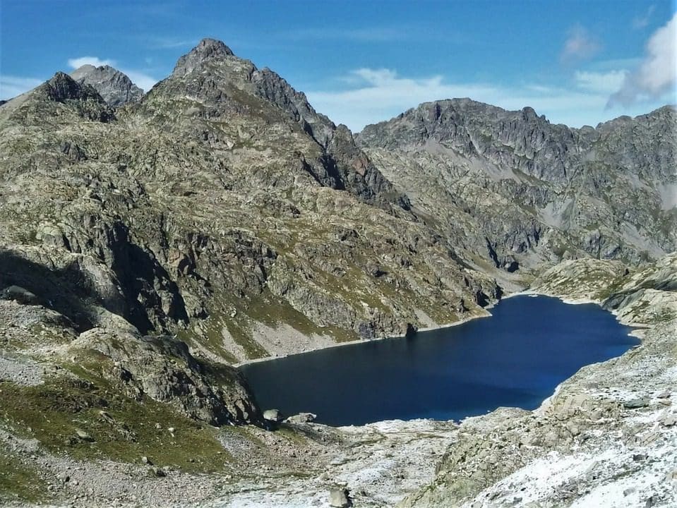
The Mercantour park is located in two departments, the Alpes-Maritimes and the Alpes de Haute Provence . Its highest point is the summit of Gélas at 3,143 meters
It comprises 8 valleys: Roya, Bévéra, Vésubie, Tinée, Cians, Var, Verdon, and Ubaye.
All these valleys reallydifferent from each other, visitors grow a big interest because they offer the opportunity to practice Hiking , mountaineering , ski hiking and many others sportive activities . The park has 600 km of groomed trails. You can find the GR 5, the GR 52A (Mercantour panoramic trail) and the GR 56 there.
It is best known for the Vallée des Merveilles, Lac d’Allos and its ski resorts in Val d’Allos.
The Roya and Bévéra valley
It stretches from the Col de Tende to the Italian border. It is a valley with arid landscapes and minerals typical of the south Mediterranean , passing from olive trees to stone pines.
To the west, we find the peaks of Mercantour and the Authion massif (Cime de l’Agnel 2927m, Cime du Diable 2685 m).
A few typical villages : Tende, Saorge, Breil-sur-Roya, Moulinet, Sospel.
The Vésubie valley
The Vésubie is the river, tributary of the Var, which has dug the valley with the same name. It is a valley with diverse landscapes, we go from olive trees to mountains forests, to glacial lakes. The village of Bollène-Vésubie dominates the Vésubie valley to the west and the Turini forest to the east
The Tiné valley
La Tinée , 75km long, takes its source in the Mercantour massif at an altitude of 2,650 meters, not far from the Col of the Bonette at the bottom of the summit of Trois Serrières. After crossing the gorges from Valabres, it flows into the Var.
La Clapière, a breaking up of the side of the mountain, affects a slope of Mont Ténibre. This is the largest landslide in Europe and one of the fastest in the world. They diverted the river using a tunnel to prevent it from creating a natural dam on the Tinée river.
The Var and Cians valley
The gorges of Cians and Daluis dug by the Cians river and the Var, have their particular Red color , resulting from the oxidation of iron contained in sedimentary rocks. They earned the name of “Colorado Niçois” by their resemblance to the famous American gorges.
The few typical villages of the valley are Entraunes, Chateauneuf d’Entraune, Guillaumes, Beuil…

The Ubaye valley
This valley formerly called Barcelonette Valley , is of glacial origin. Its altitude ranges from 771 meters, at the Serre-Ponçon lake, up to 2,655 meters at the source of the Ubaye. Its highest point is the Aiguille of Chambeyron at 3412 meters. The two largest villages are Barcelonette and Jausiers.
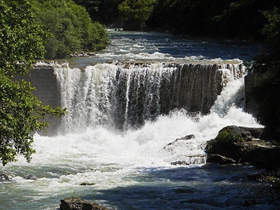
The Verdon valley
The Upper Verdon valley is made up of forests , peaks, lakes and pastures , where you can watch sheeps and cows graze peacefully. The torrents descend these ravines of black marls, to then give way to the largest canyon in Europe , dug slowly by the Verdon river between the villages of Castellane and Moustiers-Sainte-Marie , from the Lac de Castillon to the Lac de Sainte Croix . These gorges offer a grandiose spectacle, beautiful viewpoints and whitewater activities, such as canoeing , rafting and aqua hiking , which allow you to visit the interior of the gorges. Another brand new, green and fun activity allows you to discover the heritage of Provence: the Trott’Elec .